Wednesday, February 21, 2018

SANTA ELENA CANYON AND MORE

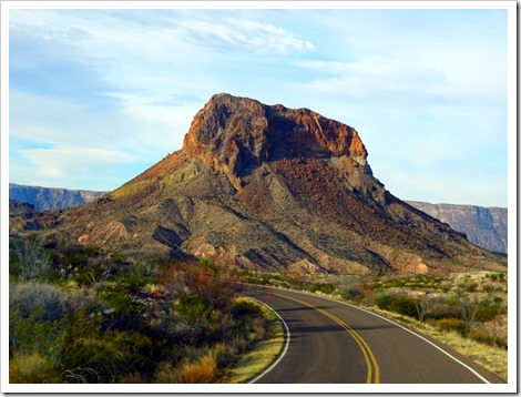
Tuesday, February 13 – We began our day here in Terlingua, TX, by heading back in the west side of Big Bend National Park. We had several stops planned along the Ross Maxwell Scenic Drive. This is a 30 mile stretch of paved road taking us to Castolon/Santa Elena. It is known for some of the grandest views in the park. It didn’t disappoint.

 Ross Maxwell Scenic Drive

 Ross Maxwell Scenic Drive

 Ross Maxwell Scenic Drive

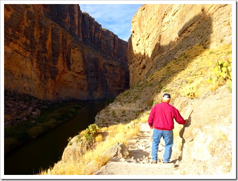
We decided to drive the complete scenic drive making Santa Elena Canyon our first stop. This hike is an easy trail of 1.7 miles hugging the mountain cliff along the Rio Grande River. It is amazing how the river carved this gorge through the mountain. These cliffs must be 300 feet or more high! After crossing Terlingua creek by way of a small board that probably wasn't even needed, we climbed a set of switchbacks and stairs to an overlook area about 100 feet above the river.

Marsha gingerly crosses the roaring Terlingua Creek.
Santa Elena Canyon

Time to climb.
Santa Elena Canyon

Santa Elena Canyon

Santa Elena Canyon

Santa Elena Canyon

Santa Elena Canyon

We then followed the trail back down to the river's edge until we reached the end of the trail about a quarter of a mile back in the canyon. A easy hike but full of amazing scenic views!

Santa Elena Canyon

End of the trail.
Santa Elena Canyon

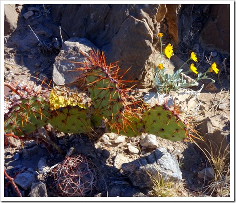
A little beauty along the way.
Santa Elena Canyon

Looking back towards the Chisos Mountains.
Santa Elena Canyon

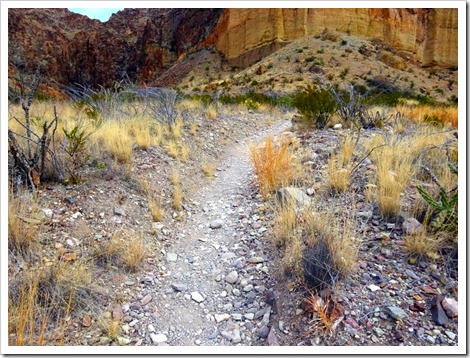
Lower Burro Mesa Pouroff was our next trail. Another easy hike of 1.1 miles.

Lower Burro Mesa Pouroff

Pretty easy trail.
Lower Burro Mesa Pouroff

Lower Burro Mesa Pouroff

Lower Burro Mesa Pouroff

The hardest part of this hike is the dry river bed we needed to maneuver down. It is tiresome to walk on the gravel in a riverbed, similar to a soft sandy beach.

Lower Burro Mesa Pouroff

Lots of debris from the rushing waters.
Lower Burro Mesa Pouroff

The trail ends at the bottom of the dramatic Burro Mesa Pour-off. This would be best described as a dry waterfall. It is where the mountain waters spill over the mountain edge to eventually reach the Rio Grande River. We imagine it's been some time since water was pouring over that cliff in this dry desert environment.

Because the mesa is capped by hard lava, the runoff sculpts a sheer
chute instead of a leisurely stream canyon. 100 foot pour-off.

Lower Burro Mesa Pouroff

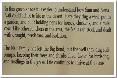
Our last stop of the day was the Sam Nail Ranch trail. Another short and easy trial less than a mile in length. The trail runs through the brush back past a working windmill to the site of the former ranch. This is a popular birding area due to the combination of water and shade.
Sam Nail Ranch trail

Remains of ranch house.
Sam Nail Ranch trail

Sam Nail Ranch trail

Sam Nail Ranch trail

Sam Nail Ranch trail

View from the Nail’s front window.
Sam Nail Ranch trail

We then headed back to BJ's Campground to relax for the remainder of the day. Another enjoyable day with awesome views and beautiful weather with temperatures in the mid-seventies.

Y’all come back tomorrow to venture with us on the longer Mule Ears Spring hike.

Thanks for stopping by. Hope to see y’all back real soon. Have a great day!

Monday, February 19, 2018

MOVED TO THE WEST SIDE OF BIG BEND

Monday, February 12 – We moved on this morning checking out of Big Bend National Park. We moved over to the west side of Big Bend pulling into BJ’s Campground in Terlingua, TX. We drove straight across the park exiting on the west end. It was an uneventful drive, but a little slow going because the speed limit in Big Bend is 45 mph and strictly enforced.

BJ’s Campground is nothing to write home about. There are 20 pull thru sites with full hookups and with a picnic table at each site. The sites are gravel, and the street is gravel, pretty dusty in the dry South Texas environment. Many of the RV'ers staying here are regulars that return each winter.

Site 11
BJ's RV Park

BJ's RV Park

Looking right. The white building at the end is the restrooms and laundry.
BJ's RV Park

Looking left.
BJ's RV Park

Outdoor gathering area.
BJ's RV Park

After setting up in Site #11, we jumped in the truck to check out two of the nearby towns. Our first stop was Lajitas, TX. This is pretty much an upscale area primarily centered around a Lajitas Golf Resort and Spa. The neighbor here at the RV park said it has recently changed hands after the developer spent a great deal of money and was unable to make it profitable. The “must see” here is the golf course pro shop. It is filled with very interesting mounted longhorn cattle heads and amazing horns. Very unique!

 Lajitas Golf Resort and Spa

Pro Shop.
 Lajitas Golf Resort and Spa

 Lajitas Golf Resort and Spa

Cool horns.
 Lajitas Golf Resort and Spa

 Lajitas Golf Resort and Spa

We couldn’t find the greens on the golf course.
 Lajitas Golf Resort and Spa

 Lajitas Golf Resort and Spa

We then stopped at Terlingua. It is an eclectic little town of mostly bars and restaurants. There is a trading post type touristy stop called the Ghost Town. We stopped and enjoyed the unusual items offered to the tourists. We plan on stopping back to enjoy the bar/restaurant at another time.

We then returned to the RV Park to relax for the of the day. Again, the weather remains outstanding with today's high of 71 degrees after a low of 37 degrees last night. Temperatures vary by about 15 degrees depending whether you are down by the Rio Grande River or at higher elevations. We have numerous adventures planned for the west side of Big Bend NP, so stop back and enjoy the area with us.

Thanks for stopping by. Hope to see y’all back real soon. Have a great day.

Sunday, February 18, 2018

BOQUILLAS CANYON TRAIL…BIG BEND

Sunday, February 11 – We woke to strong winds in Big Bend National Park. We waited awhile to head out hoping the winds would subside. We finally decided they weren't going to lesson, so we headed out for our planned short hike.

We chose an easy hike for our last day on the east side of Big Bend NP. Boquillas (Bo-key-us) Canyon Trail is 1.42 miles long. It begins with a short climb and descends down to the Rio Grande River via a sandy trail with some stairs. The river is fairly narrow here, probably only 30-40 feet wide.

BOQUILLAS CANYON TRAIL…BIG BEND

BOQUILLAS CANYON TRAIL…BIG BEND

BOQUILLAS CANYON TRAIL…BIG BEND

Beauty along the trail.
BOQUILLAS CANYON TRAIL…BIG BEND

BOQUILLAS CANYON TRAIL…BIG BEND

BOQUILLAS CANYON TRAIL…BIG BEND

BOQUILLAS CANYON TRAIL…BIG BEND

The Canyon.
BOQUILLAS CANYON TRAIL…BIG BEND

BOQUILLAS CANYON TRAIL…BIG BEND

More beauty at Big Bend.
BOQUILLAS CANYON TRAIL…BIG BEND

There isn't much of a border patrol presence here. We saw a Mexican cowboy on horseback driving a couple cattle across the river to the US side for grazing and also saw more trinkets for sale.

BOQUILLAS CANYON TRAIL…BIG BEND

Man was the wind intense blowing down the Boquillas Canyon. It must have been gusting to 40 or 50 mph. It nearly blew us to Mexico. With that wind, we didn't linger long and were back to the truck and returning to the RV park in short order.

BOQUILLAS CANYON TRAIL…BIG BEND

We spent the remainder of the day relaxing at the RV and doing a little preparation for our departure tomorrow morning. When you hear from us next, we'll be in Terlingua, TX, on the west side of the National Park.

Thanks for stopping by. Hope to see y’all back real soon. Have a great day!