Friday, February 17, 2017

HIKING AND BIKING AT HICKIWAN TRAILS RV PARK

Sunday, February 12 – Hickiwan Trails RV Park is located on Tohono O'odham Nation Reservation. There are miles and miles and miles of desert all around us. We really enjoyed biking/hiking in the desert. There are numerous hiking/biking trails all around the park.

Hickiwan Trails RV Park

Hickiwan Trails RV Park
During our rides, we frequently found clothing, water containers and other signs of aliens passing through the area.

Hickiwan Trails RV Park
We have never felt threaten by these items. It is a common site in the Southwest.

Thanks for stopping by. Hope to see y’all back real soon. Have a great day!

THE TOWN OF AJO, AZ

Saturday, February 11 – Since Marsha is using Blogger right now to post, if you use Feedly to read the blog, you may notice extra blank lines. You might want to consider reading the post on our website.

We enjoyed strolling around Ajo, AZ, this morning at the weekly farmer's market. It wasn't very big but was certainly well attended. The only purchase we made was a cup of coffee and a breakfast burrito. Our contribution to the struggling local economy.


Ajo is an historic mining town. Once part of Mexico, the Spanish mined silver here as far back as 1750. The entire town was built to house and support the Cornelia Mine that opened in 1914. In 1931 The Phelps Dodge Corporation acquired the mine and most of the town. By 1960, the population of Ajo swelled to over 7000 people. In 1984, during a bitter strike, the mine closed causing many families to leave town. We took a tour of Ajo by following a self-guided walking tour.

The old railroad station is now the visitor’s center.


The Plaza.


There are two churches across the street from the Plaza where the farmer's market was held. The Immaculate Conception Catholic Church completed in 1925 is an adobe construction and very simply done both inside and out.


Not to be outdone, the Federated Church, designed in 1926 and directly across the street, lacks almost all ornamentation. We were not able to enter the church.


The former Curley School, located at the end of Lomita Street which begins at the square, has been totally renovated to provide living and work space for 30+ artists. This school was originally owned by the New Cornelia Phelps Dodge Mining Company.


Beautiful architecture.


A very nice art gallery.


We then drove up to an open-pit mine viewing area to see the New Cornelia mine. WOW! One and a half miles across and 1100 feet deep, the mine was one of the largest in the country at one time. At one time, it was the largest producer of copper in Arizona. Gold, silver, and molybdenum were also mined here.


We were so fortunate to meet Bob Hightower at the viewing area. He is now the Ajo Historian and worked over 35 years at the mine. He volunteers at the Mine Museum and is a wealth of information about the mine and the city of Ajo. He gave us a printed information sheet, but it was nothing compared to the information he shared with us. He recalls working at the bottom of the pit during the summer where temperatures reached 165 degrees. To reach the bottom of the pit, one would ride a train down the spiraling route 32 miles. It took over 6 hours for a fully loaded train to travel out of the pit.

Ajo, AZ


They could drive the train without being in the engine.
Ajo, AZ
What one of the trains looked like.
Ajo, AZ
Over 200 men worked on the railroad alone! Bob spoke to us for over an hour. We were mesmerized with his knowledge. He and his wife volunteer at the mine Visitor's Center six days a week, so be sure to speak with him if you ever visit the mine.

Ajo, AZ
We really enjoyed our day in Ajo, AZ. A town full of very friendly people.

Thanks for stopping by. Hope to see y’all back real soon. Have a great day!

Thursday, February 16, 2017

ORGAN PIPE CACTUS NATIONAL MONUMENT

Friday, February 10 - We headed about 20 miles south this morning from our campground in Why, AZ to Organ Pipe Cactus National Monument. Our first stop was the Visitor's Center where we watched a 15 minute video about the park and talked about different hikes with the park ranger.

Organ Pipe Cactus National Monument

Organ Pipe Cactus National Monument


This is the cactus the park in named after.
Organ Pipe Cactus National Monument


We decided on Victoria Mine trail. It is a 4.5 mile trail that is rated as easy. We must be feeling our age because we both felt moderate would be a better rating.

Organ Pipe Cactus National Monument


Organ Pipe Cactus National Monument

Organ Pipe Cactus National Monument


It crosses several washes and is a series of  short uphill and downhill switches.

One of many washes.
Organ Pipe Cactus National Monument


Beautiful scenery all around.
Organ Pipe Cactus National Monument


Blooming Ocotillo.
Organ Pipe Cactus National Monument


We had to ask this guy directions, but had no idea which direction he was telling us to go.

Organ Pipe Cactus National Monument


Organ Pipe Cactus National Monument


The hike ends at Victoria Mine, home of one of the oldest historic sites on the monument grounds. The old mine shafts are covered with steel grating to prevent entrance and to protect the bat population living within the mine. The ruins of the miner's house remain at the sight.

Organ Pipe Cactus National Monument


Organ Pipe Cactus National Monument


Organ Pipe Cactus National Monument


We paused at the mine for a small snack before beginning our return hike back to the trailhead. According to our I-phone apps we covered a total of about 5.5 miles, 15,984 steps and were on the trail about 3 hours. It was in the high 80's by the time we reached the parking lot, so we were happy to be off the trail.

We were within five miles of the Mexican border, so Paul wanted to drive down to see the current wall. We had to drive two miles down a washboard dirt road to reach the border.

The Wall


Surprisingly, we did not see any Border Patrol, but they probably knew we were there. The wall was a steel mesh and about 12 feet high.

Can you see it going all the way up the mountain?
The Wall

The Wall


Mexico.
Mexico


We then returned to the desert along AZ Highway 85 in search of Crested Saguaro cactus. The brochure we obtained at the Visitor's Center calls them Cristate Saguaro cactus. (What do you think, Pam?) They are called Cristates because they often resemble the crests found in medieval times. This anomaly is rare but can be found on cactus scattered across the Southwestern United States. We found three today. Yea for us!

Cristate Saguaro
Cristate Saguaro


This one was right along HWY 85.
crested cactus

crested cactus


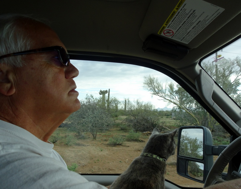
Bella even enjoys looking for crested saguaro and found one!
Bella


We returned home to the Hickiwan Trails RV park to find a welcoming crowd of donkeys “honking” are arrival. They were right by the front gate having visited the pond behind the casino. Funny!

Thanks for stopping by. Hope to see y’all back real soon. Have a great day!