Thursday, February 15, 2018

BIG BEND…LOST MINE TRAIL…BEAUTIFUL

Thursday, February 8 – What a difference being prepared for a hike! We started our day here in Big Bend National Park by driving the 30 miles back to Chisos Basin to take on the Lost Mine Trail. We were properly prepared for today's hike after yesterday's last minute decision to go ahead down the trail even though we didn't have our hiking equipment. Paul even packed in some pain medication for his arthritic hip. Lets go!

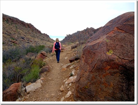
This is how Lost Mine Trail greets its guests.
Lost Mine Trail...Big Bend

Lost Mine Trail...Big Bend

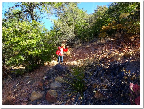
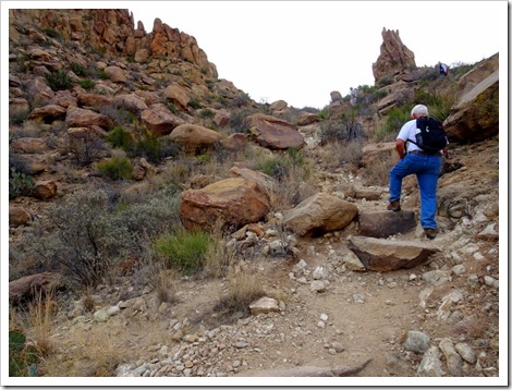
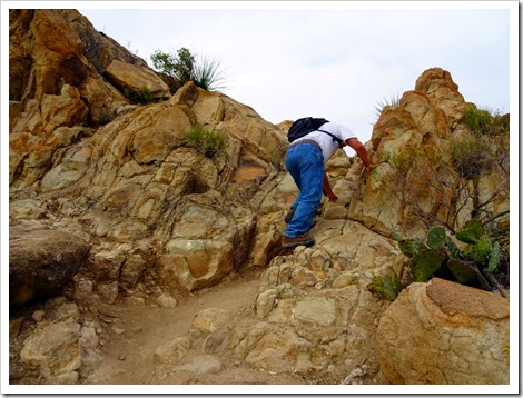
The Lost Mine Trail begins with an uphill climb lasting about two hours until we reached the top of the mountain. The elevation change is about 1,600 feet. The trail is a series of switch backs with some trail type stairs mixed in. There are some areas of gravely rock and large rock surfaces and some slick rock type surface but most is a dirt surface. The trail is easy to follow and in good condition.

The trail.
Lost Mine Trail...Big Bend

Lost Mine Trail...Big Bend

Lost Mine Trail...Big Bend

Lost Mine Trail...Big Bend

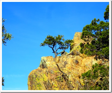
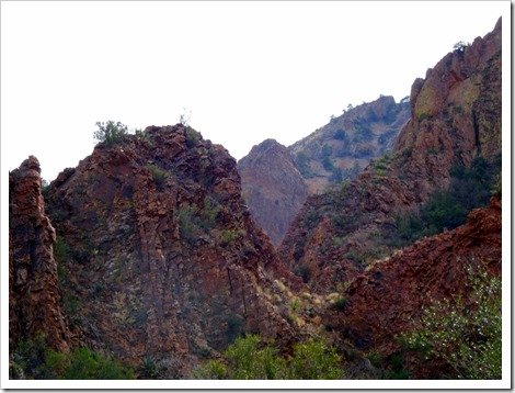
Beauty along the trail.
Lost Mine Trail...Big Bend

Lost Mine Trail...Big Bend

Isn’t Nature amazing.
Lost Mine Trail...Big Bend

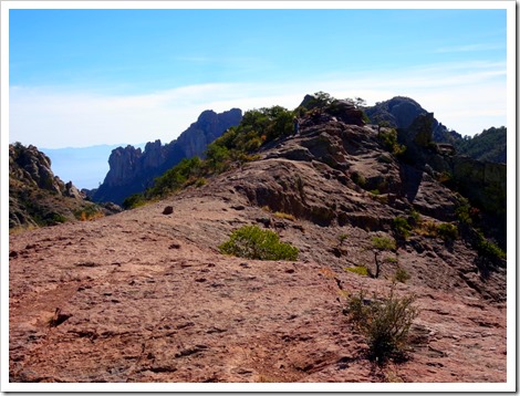
There is no mine at the end of the trail. It got it's name from an old story similar to the Lost Dutchman Mine tale in Arizona. The bonus at the end of the trail is the gorgeous panoramic view. We paused at the top for a relaxing snack, some water, and numerous pictures before heading back down.

That is the end…way up the hill.
Lost Mine Trail...Big Bend

Lost Mine Trail...Big Bend

Lost Mine Trail...Big Bend

Lost Mine Trail...Big Bend

This trail is marked moderate in difficulty on the trail map. We agree with that grade. We might give it a moderate+, if there is such a thing. The total distance was 5.1 miles and 14,103 steps according to our iPhone app. It took us about four hours to complete the hike including our lunch and picture breaks. The temperature was 49 degrees at the start (36 degrees overnight) and 76 degrees when we finished. Perfect weather for hiking!

Snack with a view.
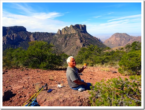
Lost Mine Trail...Big Bend

We really enjoyed this hike and recommend it as “not to miss” if in the area. Equal in enjoyment to the Balance Rock hike and better than the Window hike. All the hikes have been very beautiful and quite enjoyable, but be prepared! We still have several more adventures planned, so stop back and enjoy Big Bend National Park along with us.

Lost Mine Trail...Big Bend

Thanks for stopping by. Hope to see y’all back real soon. Have a great day!

Tuesday, February 13, 2018

CHISOS MOUNTAINS…WINDOW TRAIL

Wednesday, February 7 – The morning here in Big Bend National Park brought us very windy and cold conditions, 44 degrees. We had a couple hikes in Chisos (CHEE-sos) Basin planned but no way were we going to hike in these conditions. We decided instead to go ahead and drive the 30 miles to Chisos Basin, visit the lodge and maybe do a couple short hikes.

The drive to Chisos Basin.
Chisos Basin

DSC00403

Wouldn't you know that weather conditions at Chisos Basin were very different. We found out that this is not an uncommon phenomena. There is a 3,000 feet difference in altitude between the Rio Grande River and Chisos Basin and thus very different weather conditions. Guess we could hike after all.

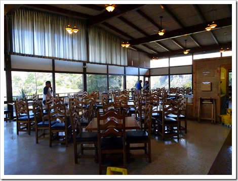
We visited the lodge which is quite nice. Nightly rooms go for about $165/night and there is a very nice restaurant, a wonderful outdoor patio/deck and a quaint lounge. Too bad it is so far to drive home, or we might have planned a night out.

Chisos Basin

Chisos Basin

Don’t see this much any more.
Chisos Basin

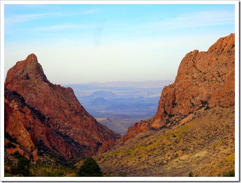
With the improved weather conditions, we reverted back to original hiking plans. Unfortunately, we did not bring our backpacks or hiking poles, but we have water bottles and a fanny pack carrier. We started with a very brief hike of .3 miles on the Window View Trail. Very short but a great view of the surrounding mountains and the “window” which is the low area between two large mountains.

Casa Grande…7,325 ft.
Chisos Basin

Far left…Emory Peak, 7,825 ft.; Crater Peak, 5.668 ft.; (the opening) the Window, 4,600 ft.;
Vernon Bailey Mt., 6,670 ft.
Chisos Basin

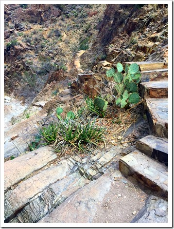
We then headed out on the Window Trail which is a 4.4 miles hike round trip out to the window area. Little did we know that it was downhill the entire way over 100's of trail steps, elevation change from 5,200 ft. to 4,400 ft., and connecting paths. That means it will be UPHILL the entire way home. Remember, we didn't have our backpacks, poles, adequate water, or energy bars for a snack. OPPS! We definitely will live to regret our decision to go ahead and hike this trail.

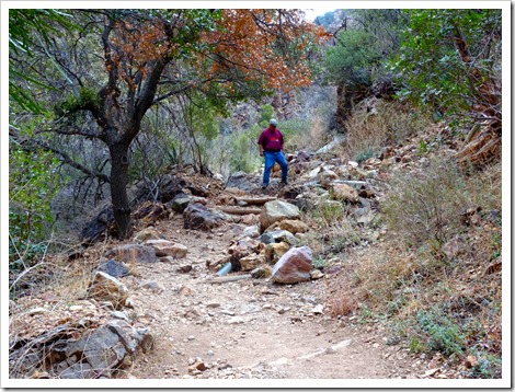
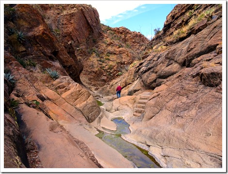
The trail was very rugged but beautiful landscape.
Window Trail...Big Bend

Window Trail...Big Bend

Window Trail...Big Bend

Window Trail...Big Bend

Window Trail...Big Bend

Window Trail...Big Bend

To add insult to injury, when we finally reached the bottom of the canyon, we discovered in order to view the “pour-off” which is the spot where the canyon waters spill over the mountain to eventually reach the Rio Grande River, it required some pretty difficult mountain climbing and rock scrambling. The end was in sight and only a hundred feet or so away. We both gave it a go, but decided it was more dangerous than these too old hikers wanted to risk. We certainly didn't want to suffer an injury way down there! Dang!

Window Trail...Big Bend

Window Trail...Big Bend

Here is where we draw the line.
Window Trail...Big Bend

Window Trail...Big Bend

The End. We just fell short.
Window Trail...Big Bend

We still had a difficult uphill climb ahead of us so, we reluctantly headed back up the trail. We were both pretty tired by the time we reached the trail head. Paul was especially shot with his replaced knees and hip. Of course, his other hip has been bothering him recently and this only assured him it was getting worse.

Window Trail...Big Bend

It was a very beautiful canyon for hiking, so at least we were able to enjoy some fantastic scenery. The hike is rated moderate, and we totally agree. Even if we had our backpack, it would have not made it any easier. Be sure to have your poles with you!

Window Trail...Big Bend

Once back on level ground, we took those last couple steps and climbed into the truck and returned to the campground. Paul had a few chores to do around the RV, and Marsha went up to the camp store to use the WiFi. We have several more hikes planned if Marsha can get Paul back on the trail.

Thanks for stopping by. Hope to see y’all back real soon. Have a great day!

Monday, February 12, 2018

VERY ROUGH ROAD LED TO BEAUTIFUL BALANCE ROCK

Tuesday, February 6 – Our first stop this morning in Big Bend National Park was the Panther Junction Visitor Center. We watched the introductory movie to Big Bend which was about 20 minutes long and was quite good. This Park is so big we have to divide it into various areas to make since of it all, and then do some serious planning so we can see the park by sections. It takes more than 90 minutes to drive across the park so we don't want to be driving back and forth. Also, there are only two gas stations in the Park, so we better keep an eye on the gas gauge and conserve when possible.

Big Bend spans 801,163 acres, which is about 1,252 sq. miles. It is the 15th largest unit in the National Park System. There are four campgrounds in the Park but only one with FHUs. There is the Chisos Mountains Lodge and Restaurant along with three camp  stores.

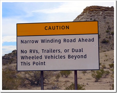
After watching the movie, we traveled about ten miles to Grapevine Hills Road, an improved back road (bumpy dirt and gravel), which we crawled down for 7.7 miles to the Balance Rock Trail.

DSC00254

This is a 2.2 mile trail through a beautiful bolder and rock area. We had to do some scrambling up a rocky trail on the side of a mountain for about a quarter mile until we reached Balance Rock. Not only is the Balance Rock amazing, but the view of the surrounding area is spectacular. Do not miss this hike! It is rated easy…pretty good description.

The trail.
Balance Rock hike Big Bend

Balance Rock hike Big Bend

Balance Rock hike Big Bend

Lots of beauty all around.
Balance Rock hike Big Bend

Balance Rock hike Big Bend

At the top.
Balance Rock hike Big Bend

Balance Rock hike Big Bend

From the other side.
Balance Rock hike Big Bend

The rock formation is super.
Balance Rock hike Big Bend

Beauty at the top.
Balance Rock hike Big Bend

Balance Rock hike Big Bend

After returning to the truck, we crawled back Grapevine Hills Road to the main road. Our next destination was Hot Springs. This is a natural heated spring that empties into a pool enclosure adjacent to the Rio Grande River. Another improved(?) road...but much better than Grapevine.  We couldn’t drive all the way back.

Hot Springs hike Big Bend

DSC00314

We hiked.
Hot Springs hike Big Bend

This little guy was a hoot….the Roadrunner.
DSC00322

Historical buildings from the past. The old store.
Hot Springs hike Big Bend

Lodging for the people and animals.
Hot Springs hike Big Bend

Everyone has read or heard how the Mexicans come across the river to sell their wares. If it is illegal to buy them in the Park, we have no idea why they allow the Mexicans to even bring the items across and set up a mini-sales booth. Good question for us to ask one of the volunteers.

Hot Springs hike Big Bend

Anyone can get in the heated pool and slip right into the River to cool off. We didn't get to enjoy the water this time. Kids were stirring up the mud, and it was way too crowded for our enjoyment. The water was really warm.

Hot Springs hike Big Bend

That is Mexico across the water on the left.
Hot Springs hike Big Bend

We got to see more pictographs.
Hot Springs hike Big Bend

Hot Springs hike Big Bend

Hot Springs hike Big Bend

We aren’t sure, but all along the water grew what we think is bamboo.
Hot Springs hike Big Bend

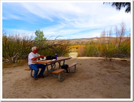
After both hikes, we were needing some nourishment.
Hot Springs hike Big Bend

We then returned to the RV to sit outside and relax in the 85 degree weather. We are amazed at how warm and sunny our time along the Rio Grande River has been. We enjoyed talking to the neighbors for awhile before getting a bite to eat for dinner and then heading out for one final adventure for the day.

We drove over to the other campground here at Rio Grande Village. It is much bigger than the area we are in but does not have hookups. Campers are only permitted to use a generator in certain areas, as well. At the back of the campground is a nature trail that leads to an elevated viewing area that is great for watching the sunset. Unfortunately, it was cloudy tonight so we'll have to return another night.

That's was enough for a day. We have much more exploring to do so stop back!

Thanks for stopping by. Hope to see y’all back real soon. Have a great day!